
Ben Leamon
Hello and welcome! Projects related to programming and mapping.
Selected Projects:


Recent Updates:
-
Map of Iceland
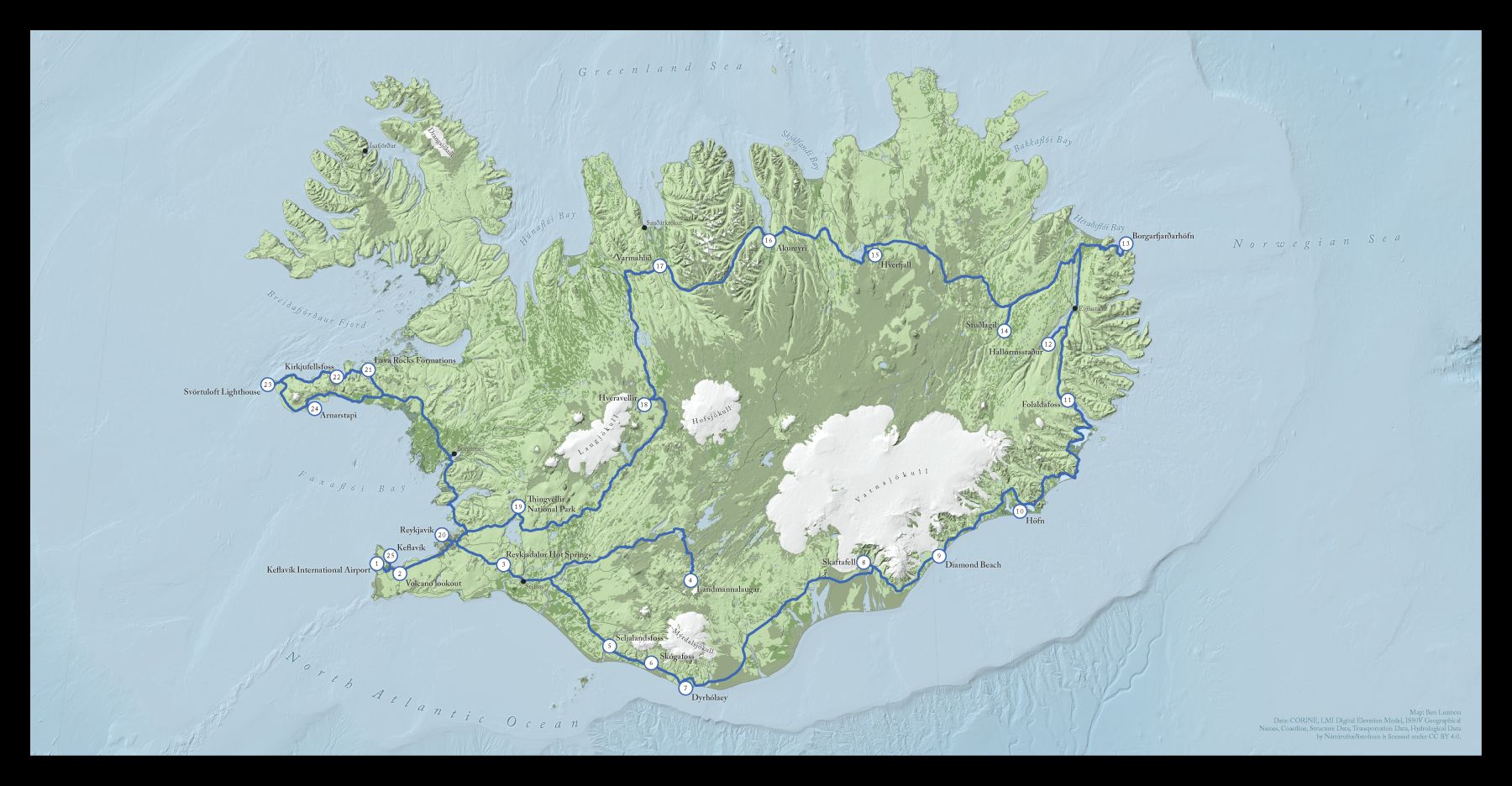
This is a map of Iceland I made for a friend. He wanted a map documenting a trip for his friend's wedding album. In this post I'll walk you through the creation process and explain some of the design decisions that went into the final map.The initial brief was to help make a map that was better than the default one generated by the publishing software he was using, which was ok, but I was pretty sure I could do better.
I downloaded almost all of the data for this map from the Náttúrufræðistofnun, or Natural Science Institute of Iceland. It was nice to have all the information I might need in once place, although English localization, especially in the metadata, was spotty. After some Google Translating and some internet research however, I was able to get the layers I wanted. (You should have a look at their map viewer if you have a moment. How cool is it that you can get seal habitats and the locations of Icelandic sagas all in one place?)
Continue reading...
-
Map of Japan
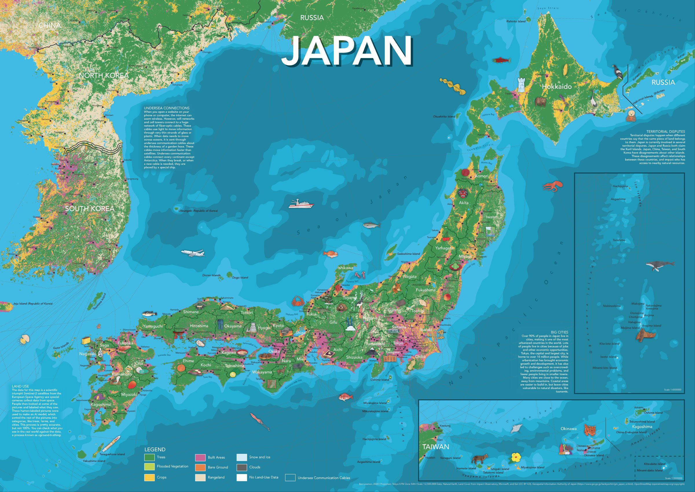
For the third (and possibly final) in my series of illustrated maps for kids, I made a map of Japan. As always, the map includes plenty of hand-drawn illustrations, prefectural and city labels, and info panels for more detail.
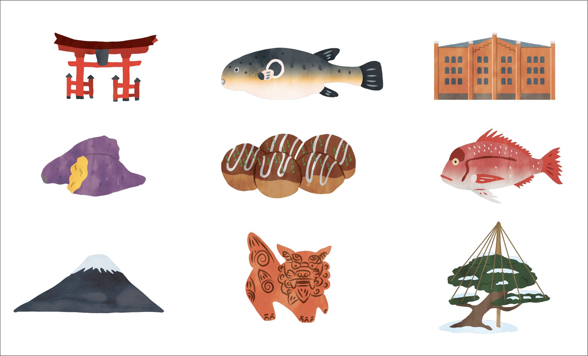
Some of the illustrations I made for the map.
If you're interested in getting a copy of the map, please email me and we'll figure something out. If you're interested in the map-making process, read on!
Continue reading... -
New Website!
This is the fourth iteration of this site. I'm not exactly sure, but I think I'm coming up on roughly six years of having this thing online. When I was writing the first version, hand-coding everything in HTML and CSS, Game of Thrones was still on TV. While I don't think I'd design it the same today, I was pretty pleased with it at the time.
Continue reading...


