While working on a different project, I came across these maps of forested land in the US, Australia, and Europe, from Earth Art Australia. I was at a bit of a roadblock in my other project, and making a map of forested land in Japan seemed like an interesting — and most importantly easy— diversion. The project, however, quickly spiraled into interminable raster-processing.
Highlights:
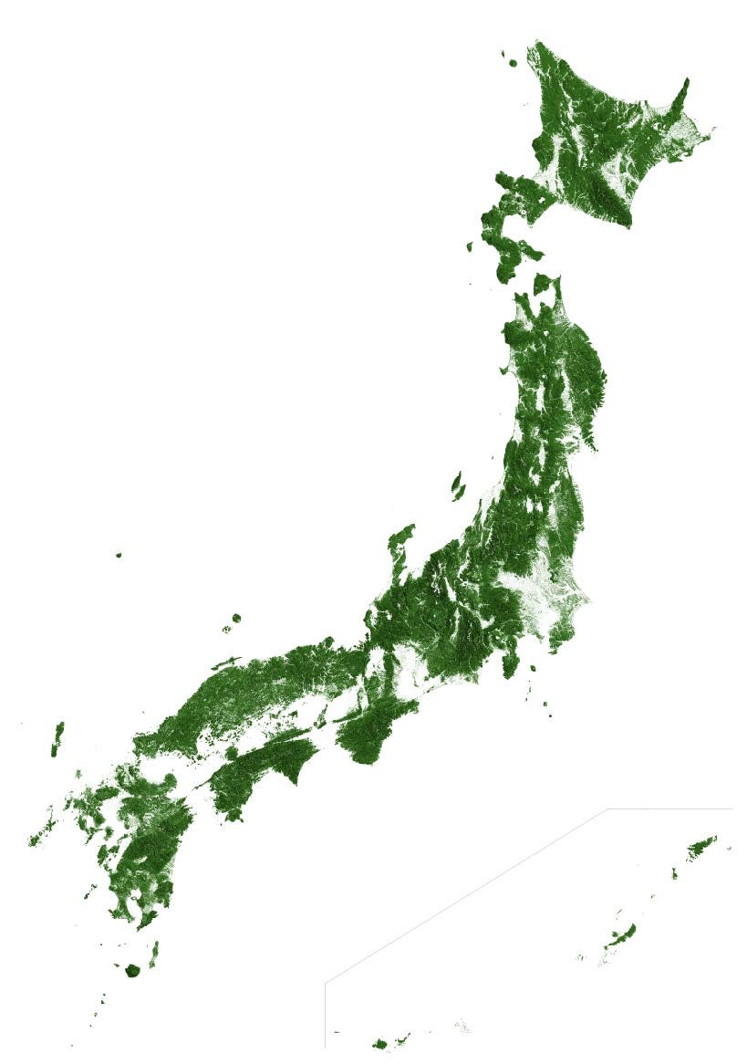
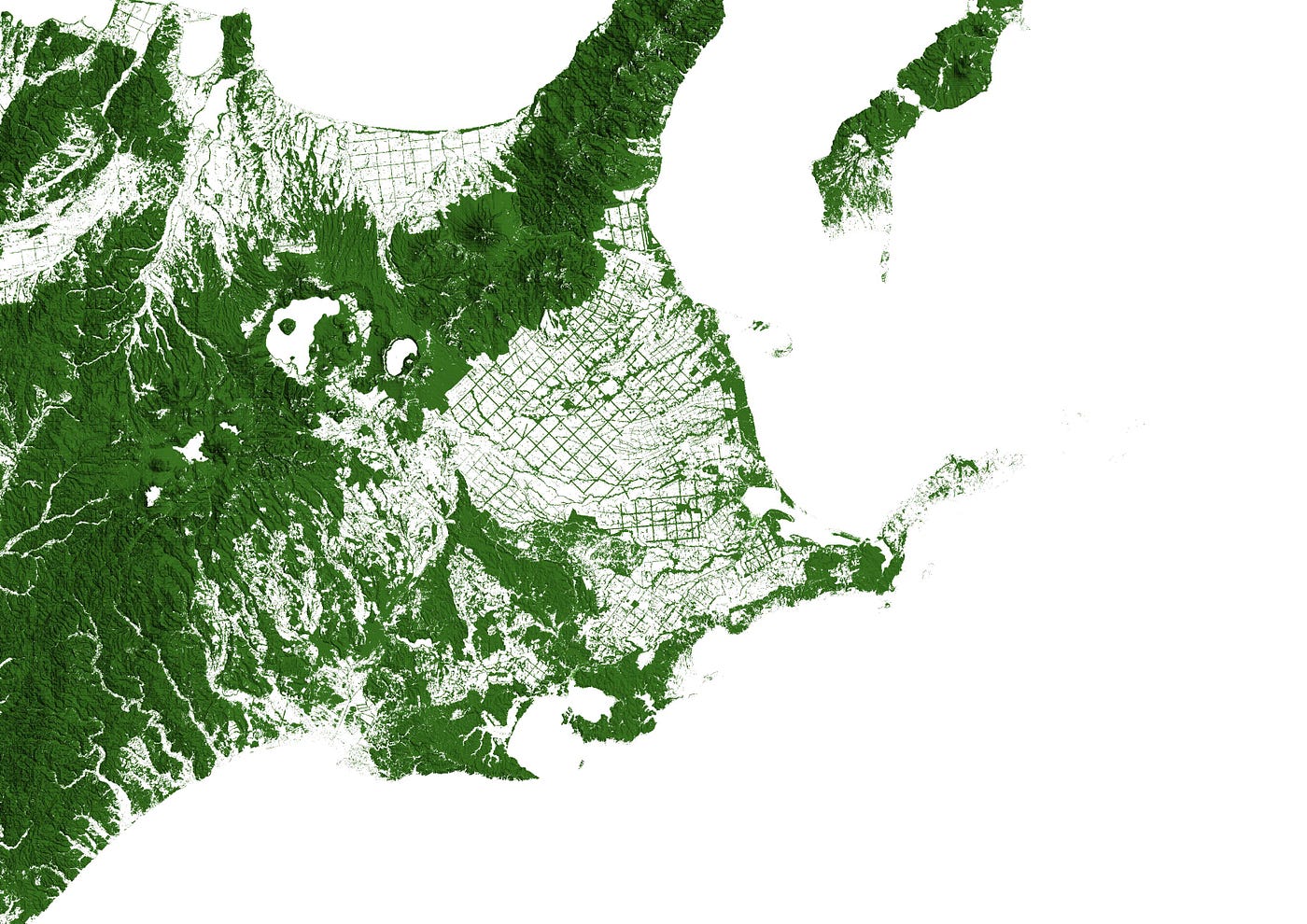
Compared to the maps of The US and Australia, the forests mapped closely to hills and mountains. North-Eastern Hokkaido, around Nakashibetsu, was interesting. Grids of agricultural fields are bordered by stands of trees.
Unsurprisingly dense urban areas like Tokyo are largely free of dense vegetation.
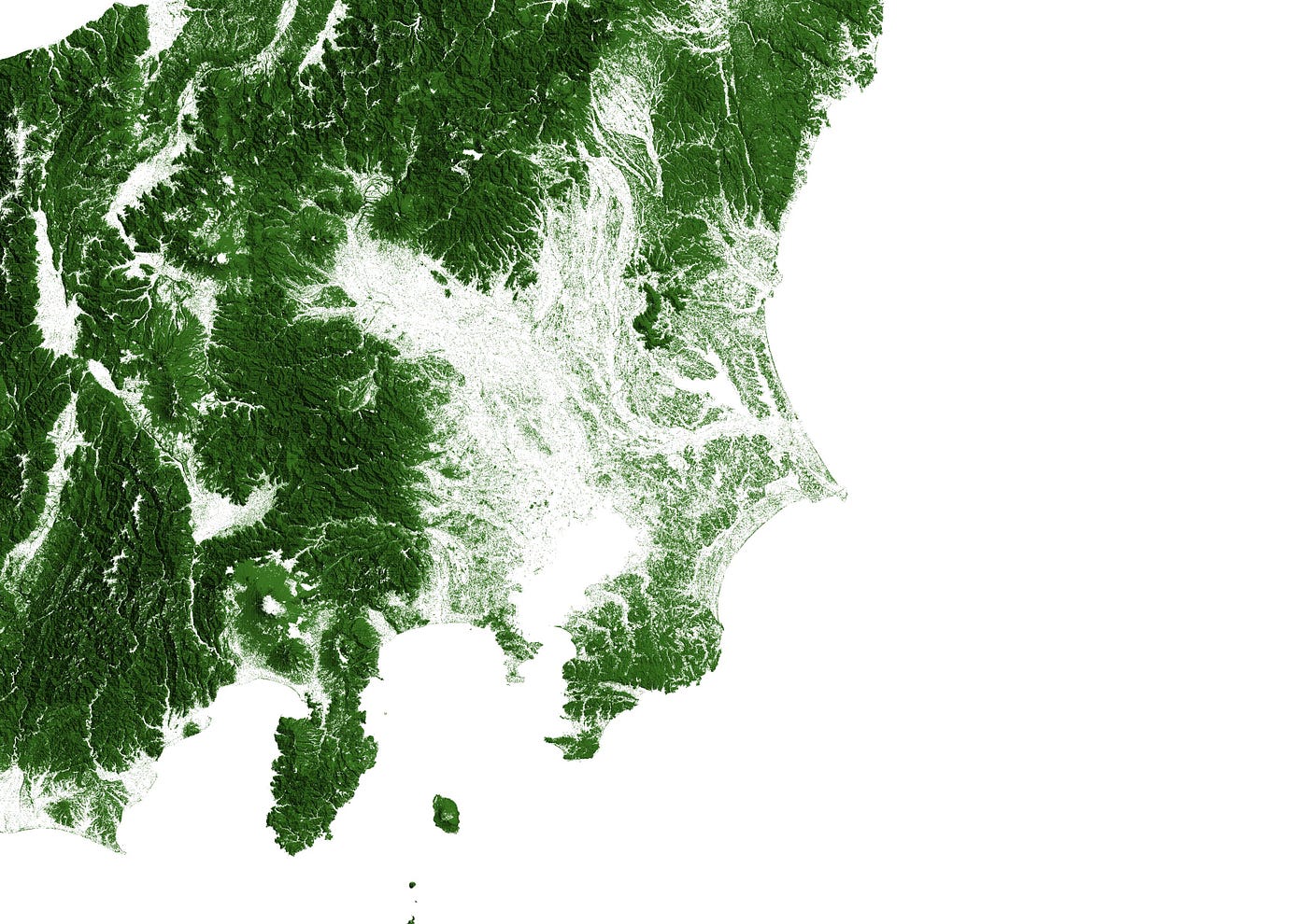
Osaka, Kyoto, and Nagoya are also pretty sparse, and in the image below you can just see the ghost of an outline around Lake Biwa. Most of the countryside is pretty green!
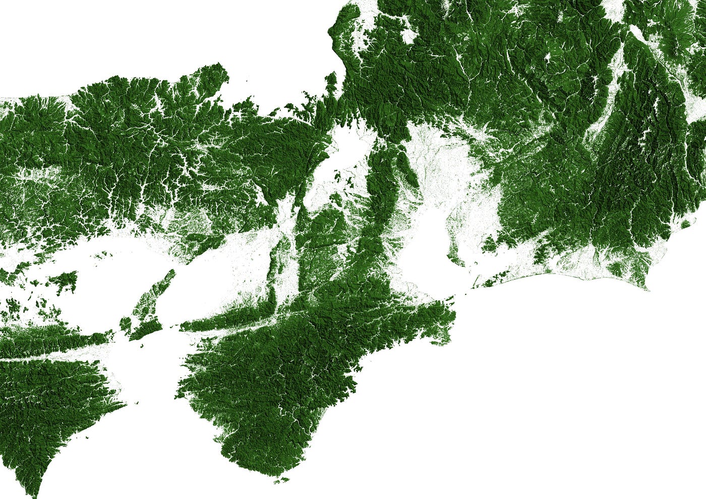
It should be noted that this data shows vegetation over five meters, and there are bound to be some errors. Overall though, it felt good being able to find something online, and reproduce it without being given any guidance. Here’s how I made the map:
Process
I used QGIS, as well as the data linked to in the original EarthArtAustralia post.
The plan for the project went as follows:
- Download the digital elevation model, or DEM, a data layer that contains elevation data for every point in our area of interest.
- Turn the DEM into a hillshade layer, and reproject it using a projection suitable for Japan.

3. Download the forest data, and reproject it using the same projection as the hillshade.
4. Write a script to delete any part of the hillshade layer that doesn’t contain any forest.

5. Use this layer as our base map, then use the forest data from step two to color it green.
Ultimately, either my computer or QGIS (probably my computer) simply wasn’t up to running a lot of the geoprocessing operations the way I wanted them to. Batch processing failed to even start on a lot of the raster layers, and performing multiple operations (for example reprojecting and saving in one step instead of reprojecting and then saving the resulting output layer separately) triggered hours-long wait times. Ultimately I completed each step on every raster tile individually, then joined the finished tiles together.
If anyone wants to make a map of their own and is running into problems, feel free to contact me, I’m happy to help!