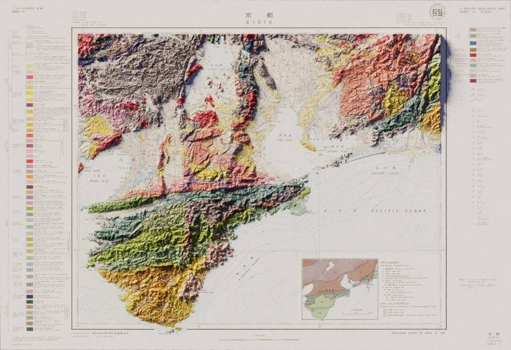
This is the first time I made in Blender using non-USGS data. The vintage map as well as the digital elevation model was readily available from the Geospatial Information Authority of Japan, but getting the data into a usable format was a bit of an adventure.
I haven’t done a full-size render of this one yet, so it might be a tiny bit fuzzy, but the key elements are all there!